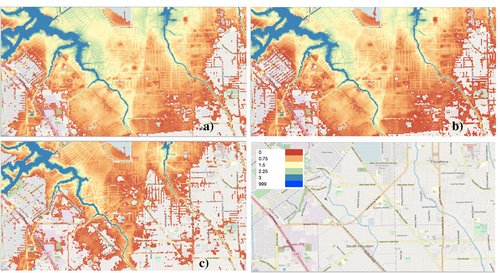
Map data of the attributable flooding in the greater Houston during Hurricane Harvey as simulated by the Fathom Global hydraulical model in a geotiff file format. The model resolution is 30 meters (about 100 feet).
The Calibrated and Systematic Characterization, Attribution, and Detection of Extremes (CASCADE) project advances the Nation’s ability to identify and project extremes and how they are impacted by environmental drivers.